|
The Geographic
Information Systems program in IRIS is actively engaged in research dealing
with spatial analyses. Faculty, students, and staff integrate remote sensing
techniques, GIS tools, and quantitative methods to conduct studies in
a wide range of contexts and at various scales, from local to global.
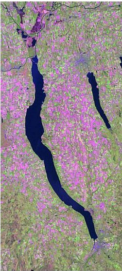
In the last few years, we have supported projects on almost every continent. We continue to build on our traditional strengths in GIS while exploring innovative uses of new and exciting software programs and computer systems in conjunction with currently available databases. During the last five years, laboratory personnel completed a number of projects focusing on issues in NYS and developed new remote sensing and GIS methods for natural resources applications. These innovations include improvement of classification schemes and methodologies, development of analytical tools for analysis of environmentally sensitive datasets, and production of relevant digital files and hardcopy maps. Current Research Completed Research
Graduate Student Research |
ArcGIS Desktop v.10 Course Descriptions
Video List |
|