
|
Hudson River Valley land cover map accuracy assessment
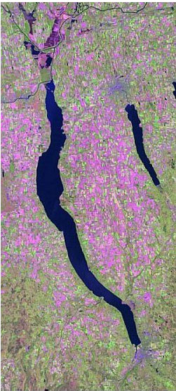
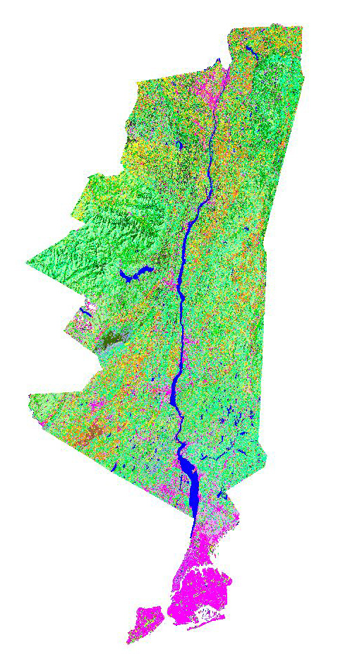 The primary objective of this project was to assess the accuracy of a Hudson River Valley (HRV) land cover map produced at a 30m spatial resolution. A key element of any land cover mapping project is to conduct a quantitative accuracy assessment of the predicted distribution of land cover classes on the landscape. An accuracy assessment provides a greater understanding of the advantages and limitations of using satellite data for land cover inventories and habitat mapping projects, gives a measure of overall reliability for a land cover map, and identifies those land cover classes and regions of the map that do not meet inventory objectives or accuracy goals. The primary objective of this project was to assess the accuracy of a Hudson River Valley (HRV) land cover map produced at a 30m spatial resolution. A key element of any land cover mapping project is to conduct a quantitative accuracy assessment of the predicted distribution of land cover classes on the landscape. An accuracy assessment provides a greater understanding of the advantages and limitations of using satellite data for land cover inventories and habitat mapping projects, gives a measure of overall reliability for a land cover map, and identifies those land cover classes and regions of the map that do not meet inventory objectives or accuracy goals.
In the first phase of this project, we developed a proper and efficient sampling design to collect valid reference data to construct the conventional error matrices associated with a quantitative accuracy assessment. To take into account accessibility restrictions, a query was performed to select only those polygons greater than 1.44 ha (3 pixels x 3 pixels) that fell within 30m of a transportation route. From this sub-sample, fifty polygons were randomly selected for each of the of 38 land cover classes. Eventually, a total of 970 polygons were visited by the field crew.
In the second phase of this project, we shall evaluate the effectiveness of accuracy assessment protocol for regional scale mapping. We shall conduct a comparative analysis of other regional scale accuracy assessments in order to make recommendations for optimum map accuracy assessment approaches for future resource inventories.
This project is conducted in cooperation with the New York Cooperative Fish and Wildlife Research Unit, and the New York State Department of Conservation, and is funded by the Hudson River Estuary Program.
Graduate
Student Research
-
Department of Crop & Soil Sciences
Cornell University is an equal opportunity, affirmative action educator and employer.
|
Research
Outreach
ArcGIS Desktop v.10 Course Descriptions Schedule
ArcGIS Desktop I
ArcGIS Desktop II
ArcGIS Desktop III
ArcGIS Web Sessions
ArcGIS 10 Basics - 1 of 4
ArcGIS 10 Basics - 2 of 4
ArcGIS 10 Basics - 3a of 4
ArcGIS 10 Basics - 3b of 4
ArcGIS 10 Basics - 4a of 4
ArcGIS 10 Basics - 4b of 4
ArcGIS Data Formats - 1 of 2
ArcGIS Data Formats - 2 of 2
Calculating XY Values for a Feature
Clip & Intersect Tools
Connecting to Web Services
Creating a Roster Catalog
Feature Templates 1
Garmin 76SX_Inro
Geodatabase Domains
Geoprocessing Results Window
Layers
Mapping XY Data |