|
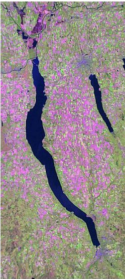
Current ResearchHudson River Valley public lands and biodiversity Sound management
of state-owned public lands is a key component of conserving biodiversity
and meeting regional conservation goals in the Hudson River Valley (HRV).
Many public lands overlap with important areas of biodiversity in the
HRV. Each parcel of New York State public land has a The major focus of our project is the development of a public lands digital database for use in land management. The database developed for this project will help to assess habitat connectivity between public land parcels and will guide acquisition of land or placement of conservation easements for biodiversity conservation. An ArcView interface will be used to compile this information in a format that is easily understood and permits manipulation to address new issues. ArcView-based tools will assist land managers in resource assessment of public lands relative to: species composition; identification of threatened, endangered or species of special concern; type and fragmentation of the vegetative cover; proximity to other public lands and biodiversity areas; and human population density of adjacent lands. This project is conducted in cooperation with the New York Cooperative Fish and Wildlife Research Unit, and the New York State Department of Conservation, and is funded by the Hudson River Estuary Program. |
ArcGIS Desktop v.10 Course Descriptions
Video List |
|

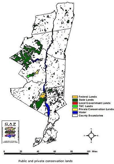 different mandate and capacity for protecting sensitive species and habitat.
This project seeks to develop science-based recommendations for protection
of biodiversity on public lands, while accounting for unique mandates.
Specific objectives of the state lands assessment are to: 1) assess the
diversity of common and rare biological resources observed in and near
management units in the HRV; 2) determine the contribution of each state-owned
land unit to the biodiversity of the region; and 3) assess actual and
potential threats to biodiversity on these lands, both internal and from
external sources (i.e., adjacent lands).
different mandate and capacity for protecting sensitive species and habitat.
This project seeks to develop science-based recommendations for protection
of biodiversity on public lands, while accounting for unique mandates.
Specific objectives of the state lands assessment are to: 1) assess the
diversity of common and rare biological resources observed in and near
management units in the HRV; 2) determine the contribution of each state-owned
land unit to the biodiversity of the region; and 3) assess actual and
potential threats to biodiversity on these lands, both internal and from
external sources (i.e., adjacent lands).