|
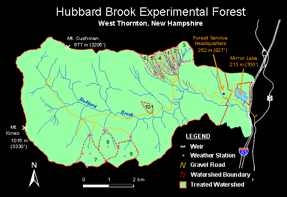
GIS Completed Research: GIS DevelopmentGIS Development A Geographic Information System (GIS) is a system of computer software, hardware, and data used to manipulate, analyze, and present information that is tied to a spatial location. IRIS has developed and implemented many Geographic Information Systems (see examples below). Montezuma Wetlands Complex, NY The objective of this project was to assemble all digital and tabular data for the Montezuma Wetlands Complex into a GIS that would be used for management of the wetland complex. The steps in this process were to identify and compile all existing digital data into an ArcView 3.x compatible format, convert all digital data into a single projection, develop complex-wide and area specific views with legends, and complement these digital data with available tabular and spatial information. Montezuma Wetlands Complex personnel were then trained in the use of this GIS. Hubbard Brook Experimental Forest (HBEF), NH Two projects were undertaken at HBEF, both of which were meant to provide technological and scientific support for the development of spatial databases and information systems for the Hubbard Brook Experimental Forest and surrounding landscapes. Major accomplishments included development of a spatial database to assess the impact of land cover dynamics on stream chemistry in the Merrimack River Basin, and development of the Hubbard Brook Site Management Information System and related data layers.
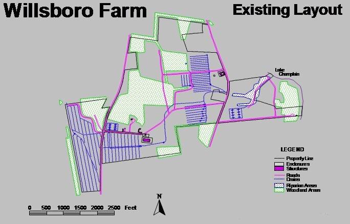
Northern New York Agricultural Development Program Willsboro Farm The objective of this project was to provide technological support for the development of an agronomic spatial information system for the Willsboro Farm, in Willsboro, New York. This involved the conversion of existing farm maps and sketches to digital data, as well as the collection of visible features via GPS. This database was designed to support farm management activities related to on-farm research and extension programs in northern New York.
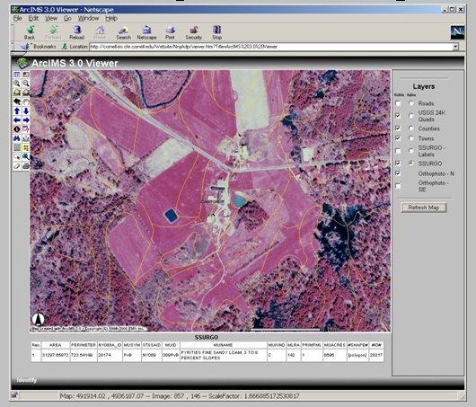
Digital Soils and the Forage Species Selection Tool The objective of this project was to investigate the feasibility of making high-resolution digital imagery, with SSURGO level soil overlays, available via a web server for county level applications, specifically, to support the Forages web site (www.forages.org). A prototype for Saint Lawrence County, New York, was developed using ArcIMS 3.0 running under an Apache Web Server on a Windows NT platform. This prototype was linked to the existing Forage Species Selection Tool to provide forage selection information for any field area selected interactively by the end user. The potential for converting this capability into a location-based service was also investigated.
|
ArcGIS Desktop v.10 Course Descriptions
Video List |
|