
|
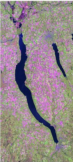
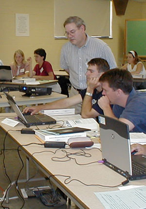
The Geographic Information Systems program at Cornell IRIS is actively engaged in outreach activities across the state. These activities include individual consultations (via voice, email, or face-to-face), public presentations, and workshops. The focus of all these activities is the dissemination of information on the features, functionalities, and implementation of geographic information systems (GIS) and image processing (IP) software. Workshop participants are offered hands-on experience in the use of GIS/IP software, its application to practical situations, and interpretation of the results.
In addition to standardized workshop offerings, specialized workshops are often developed. Tailored to a client's needs, these workshops balance the training, consultation, and product development needs with the sponsor's financial and time constraints.
Typical worshops target:
- Individuals or groups who know that their particular application would benefit from the use of a GIS or image processing software, but need assistance with hardware/software selection and installation, as well as with database development.
- Individuals or groups who have the necessary hardware but need to know what software to install, which databases to acquire in order to address their research question, and how to display and interpret results.
- Individuals or groups who have successfully set up the software for their particular application but need assistance with the interpretation of outputs.
Workshops are held on the Cornell campus and at various locations within New York State. Off-campus workshops do not require a computer facility. IRIS has several laptop computers dedicated to workshop activities, allowing workshops to be given almost anywhere.
Outreach clientele include Federal, State, and Municipal-level governmental institutions, not-for-profit organizations, non-governmental organizations, and private companies.
For workshop costs and scheduling information, contact:
Steve D. Smith
GIS Program Leader
1018 Bradfield Hall
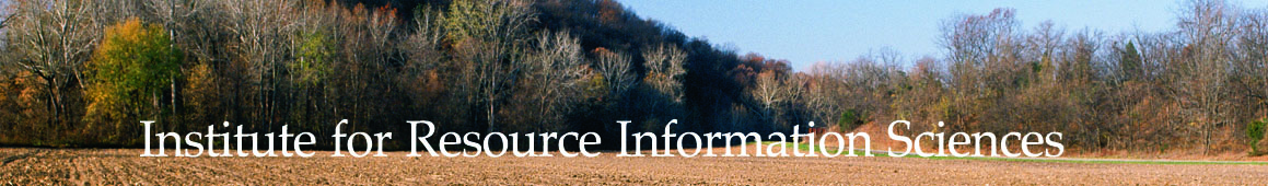
Institute for Resource Information Sciences
Department of Crop & Soil Sciences
Cornell University
Ithaca, NY 14853
Phone: (607) 255-0803
Email: sds3@cornell.edu
Department of Crop & Soil Sciences
Cornell University is an equal opportunity, affirmative action educator and employer.
|
Research
Outreach
ArcGIS Desktop v.10 Course Descriptions
ArcGIS Desktop I
ArcGIS Desktop II
ArcGIS Desktop III
ArcGIS Web Sessions
Video List
ArcGIS 10 Basics - 1 of 4
ArcGIS 10 Basics - 2 of 4
ArcGIS 10 Basics - 3a of 4
ArcGIS 10 Basics - 3b of 4
ArcGIS 10 Basics - 4a of 4
ArcGIS 10 Basics - 4b of 4
ArcGIS Data Formats - 1 of 2
ArcGIS Data Formats - 2 of 2
Calculating XY Values for a Feature
Clip & Intersect Tools
Connecting to Web Services
Creating a Roster Catalog
Feature Templates 1
Garmin 76SX_Inro
Geodatabase Domains
Geoprocessing Results Window
Layers
Mapping XY Data |