|
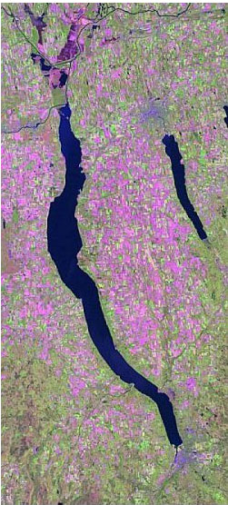
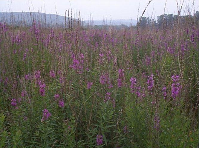
Current Research Purple loosestrife research and mapping The primary objective of this project was to map the progression of invasive plant species in aquatic and terrestrial. Traditionally, this mapping is carried out using aerial imagery but new techniques, like those based on hyperspectral data, offer the prospect of making it considerably easier. In the first phase of this project, the land areas that could potentially support plant communities dominated by purple loosestrife (Lythrum salicaria L), common reed (Phragmites australis), and cattail (Typha spp.) are mapped using digital orthophoto quarter-quadrangles and Enhanced Thematic Mapper imagery. Maps of these potential areas are produced, and statistics will be reported. The anticipated outcomes are to (1) have an improved understanding of the degree to which these plant communities can be mapped by advanced remote sensing systems, and (2) to clarify the distribution of these communities in the Hudson River Valley (HRV). Inventory and monitoring questions that we hoped to address include: what proportion of the HRV is suitable habitat for purple loosestrife-, reed-, or cattail-dominated plant communities and where are these sites located? In the second phase of this project, the recently developed Derivative Spectral Analysis (DSA) is applied to field data gathered in the Summer of 1999, to differentiate among plant community types in wetlands in upstate New York populated with purple loosestrife, common reed, and cattail. First, second and higher-order derivatives of the reflectance spectra of nine field plots, varying in plant composition, are calculated and analyzed in detail to identify spectral ranges in which one or more community types have distinguishing features. On the basis of the occurrence and extent of these spectral ranges, experimental observations suggest that a near-perfect differentiation among community types, down to the plot level, was feasible on August 30, at a time when plants experienced characteristic morphological changes (transition from flowers to seed heads). Generally, dates in August appear optimal from the point of view of species differentiability and should be selected for data gathering.
This project is conducted in cooperation with the New York Cooperative Fish and Wildlife Research Unit, and the New York State Department of Conservation, and is funded by the Hudson River Estuary Program.
Laba, M.,
S.D. Smith, and M.E. Richmond. 2004. Purple loosestrife research and mapping
for the Hudson River Valley study area, Final Report. New York Cooperative
Fish and Wildlife Research Unit, Department of Natural Resources, Cornell
University, Ithaca, NY. |
ArcGIS Desktop v.10 Course Descriptions
Video List |
|