|
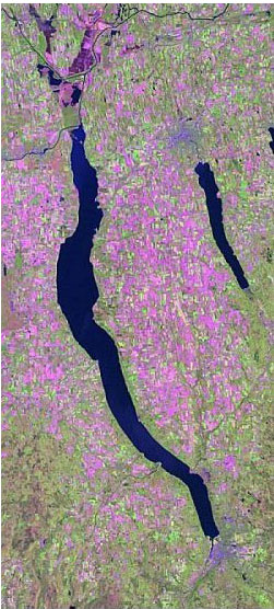
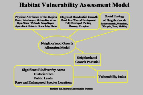
GIS Current Research: Habitat VulnerabilityHabitat vulnerability and socio-economic variables The primary objective of this project is to identify areas of high biodiversity that are vulnerable to population pressures and residential land development. The anticipated outcomes are (1) to development of a growth allocation model that permits the allocation of growth independently of minor civil divisions, local land use controls, and has statewide applicability, (2) to use this model to identify areas of potential residential development in the Hudson River Valley, and (3) to perform a biodiversity areas risk assessment based on these potential growth areas. Using readily available data from the 1990 and 2000 Census of Population and Housing, a growth allocation model that functions at a neighborhood block group level will be created. In this model, socioeconomic, urbanization, lifecycle, race, and mobility data will be combined to produce a measure of social ecology for each block-group. In addition, housing density and market values will be utilized to compute a residential growth stage for each block-group. The final input group for the growth allocation model is the physiographic features that prevent, inhibit, or promote residential growth. The resulting growth allocation information will be combined with probable high biodiversity areas to create a vulnerability index for these areas. Additional implementation of the allocation model could include vulnerability assessments for: historic sites, public lands, and locations of rare and endangered species.
This project is conducted in cooperation with the New York Cooperative Fish and Wildlife Research Unit, and the Cornell Institute for Social and Economic Research, and is funded by the Hudson River Foundation.
|
ArcGIS Desktop v.10 Course Descriptionse
Video List |
|