|
Institute for Resource Information Sciences (IRIS)Educational MaterialsBarnaba, E.M., M.Krasny, L.Kasperek, S. Hoskins, J.Hope. Explorations from an Aerial Perspective, A Program Manual. January 2000. pp 200. Text, Exercises, Case Studies, Resource Packets. Barnaba, E.M., M.Krasny, L.Kasperek, S.Hoskins, J.Hope. Explorations from an Aerial Perspective, Student Workbook. January 2000. pp34. Exercises, Resource Packets. Barnaba, E.M., S.B.Hoskins, J.M.Hope. NERRS from an Aerial Perspective, A Program Manual for the National Estuarine Research Reserve System workshops, 1995 and 1993. Barnaba, E.M., S.Hoskins. 1994 Short Course Training Manual, An Introduction to Airphoto Interpretation with Emphasis on Land Use. Barnaba, E.M., A.W.Ingram. 1990 Hudson River Curriculum and Resource Specialists Training Program. "Applications for Airphoto and Mapping Tools to Enhance Environmental Problem–Solving, A Case Study in the Hudson Basin. Barnaba, E.M., A.W.Ingram, W.R.Philipson. Educator Enrichment Program Training Manual "Applications of Airphoto Interpretation to Environmental Problem Solving –Tools for Enhancing Environmental Decision-Making." For use in 4-H, earth science and social science programs. 1989. Hoskins, S.B., E.M.Barnaba, A.Ingram. Slide/Tape Education Program - "The Potential to Contaminate Groundwater from Abandoned Landfills, the Use of Airphotos as an Assessment Tool." Using the Schatz Landfill Case Study, Dutchess County, N.Y., a program was produced that includes 75 -35mm color slides, script and tape to demonstrate how historic airphotos can help to document land use activities that potentially pollute groundwater Inventory of County Based Aerial Photography, New York State 1926-1968. A directory published June 1990. "A View of Central New York" - a poster designed with Warren Philipson and Cornell University Publications as outreach to educate and inform the general public about remote sensing by exhibiting the Finger Lakes of New York as photographed by astronauts of NASA's Skylab Satellite. Philipson, W.R., E.M.Barnaba, A.Ingram. 1986. Basic Airphoto Interpretation Short Course Manual. This material formed the basis for a series of short courses and workshops offered during the period 1985-1990.
|
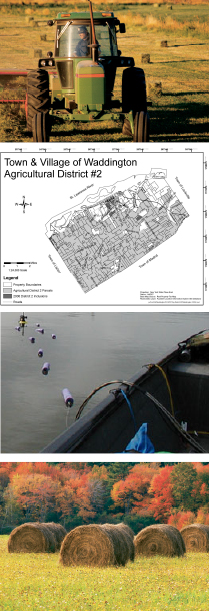
New York County New York County Agricultural District Mapping Checklist (pdf) NYS Farmland Protection Agriculture Districts (pdf) National Wetlands Inventory Maps Order Form (NWI) (pdf)
|
|