|
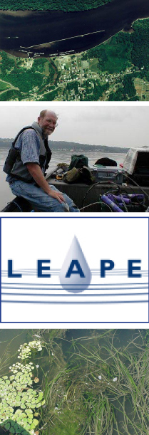
Institute for Resource Information Sciences (IRIS)Mapping of invasive plant species using advanced remote sensing technology for the Cooperative Institute for Coastal and Estuarine Environmental Technology (CICEET)Staff in the Resource Inventory Program will collaborate on a multi-year project to investigate the application of high-resolution satellite imagery (IKONOS) to vegetative mapping in an estuarine wetland environment. An overall goal is to evaluate high spatial resolution imagery that combines the spatial scale of an aerial photo with the ease of digital image processing. This combination of new methodology and map products will enable managers of wetland sites, particularly National Estuarine Research Reserve sites, to identify plant species and address habitat changes issues in a timely fashion. The ultimate goal is to develop workshop curriculum and disseminate project results to resource managers. Principal investigator on this project is Stephen Smith, program leader in geographic information systems. Locally-led Education and Action for Protecting the Environment (LEAPE) Remote sensing, resource inventory and geographic information systems (GIS) are tools widely used in the collection, organization, analysis and management of environmental data. Users include local, state and federal governments, private engineering and environmental consultants, environmental groups, as well as the general public. Educational programs can be designed that adapt the application of these tools to create awareness of the community environment from the aerial perspective and to empower locals in community-based environmental management. IRIS worked with a group of Cornell faculty and staff in a collaboration to develop a program and process for education and technology transfer in community-based environmental management, focused around a selected issue. One example of an issue might be septic tank management. Over a three year period, a multi-phased effort incorporated: (1) the creation of educational materials for hands-on workshops to be implemented in 2-3 pilot communities with varying levels of sophistication; (2) the development of a mobile computer lab for use in regional training; and (3) educating regional trainers in the use of remote sensing imagery, resource inventory and geographic information systems, and, in the utilization of the mobile computer unit for extending the model community-based environmental management program. For more information about LEAPE, visit the LEAPE web site at www.css.cornell.edu/leape/. Other Research Areas Hudson River submerged aquatic vegetation (SAV) inventory & mapping Publications
|
New York County New York County Agricultural District Mapping Checklist (pdf) NYS Farmland Protection Agriculture Districts (pdf) National Wetlands Inventory Maps Order Form (NWI) (pdf)
|
|